
Climate change and risks Reading time 5 min
Lionel Benoit, rising high in science – with resolution
Published on 31 January 2022
On leaving school in his native Vosges with a baccalaureate in the sciences, Lionel Benoit set off for Nancy, the ‘town next door’, to hone his skills and knowledge in mathematics and physics for the stringent Grandes Écoles entrance examination.
From maps to geostats
The place he won in 2008 at the Ecole Nationale des Sciences Géographiques, just outside Paris, in 2008, allowed him to discover a world of mapping, remote sensing, geodesy (exploring the dimensions and form of the Earth), and photogrammetry (the reconstruction of a three-dimensional object using multiple photographs).
Firmly hooked on the earth sciences, Lionel embarked on a PhD at the IGN, the French national institute for geographic and forest data. In his doctoral work, he developed software to measure deformations in the Earth’s crust through the real-time processing of GPS observations acquired using low-cost sensors, to assist in the management of geotechnical hazards. He was able to see his work put to practical use in the design of a network of environmental geolocalised receivers known as Geocubes, and to be involved in the subsequent technology transfer to a start-up, Ophelia Sensors, which now supplies Geocubes across the world. Lionel’s own contribution enabled millimetric deformations in kilometre-scale objects to be monitored in real time.
Geocubes are devices that contain sensors to monitor the movement of the earth at high resolution. They also make it possible to monitor kilometre-scale objects (such as major infrastructure, landslides and glaciers).
Lionel’s work on Geocube applications to monitor glaciers and landslides made him aware of the importance of the influence of rainfall on the dynamics of the earth’s surface.
He took the decision to investigate stochastic (probabilistic) rainfall modelling further, beginning work on a second PhD in the earth sciences. This time, his work concentrated on the observation and modelling of rainfall at local scale (with an area of interest of the order of 100 km2), looking for ways to quantify its temporal and spatial variability.
He would go on to develop a new stochastic model that could integrate high-precision rain gauge measurements, making it possible to map rainfall to a very high resolution (100m in space and 1 min in time). The model, designed to characterise rain fields and their impact on the environment (pluvial and fluvial flooding, landslides), has opened the way for the creation of numerous rainfall management applications.
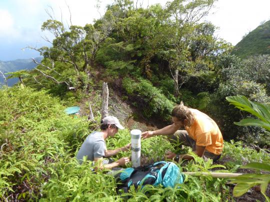
In 2020, Lionel was to be found working in the islands of the Pacific, modelling orographic rainfall events for a project to improve understanding of how topography and atmospheric circulation interact to generate the steep precipitation gradients observed in high tropical islands.
An orographic rainfall event occurs when moist air is forced to rise by a topographical barrier such as the steep sides of mountains and high hills (in a process known as orographic lift).
And then, a year later, he began work as a research scientist in the Biostatistics and Spatial Processes (BioSP) Research Unit at INRAE’s Provence Alpes Côte d’Azur Centre.
From observation to statistical modelling
Producing spatial and spatio-temporal statistics in a form that can help the environment, ecology, epidemiology and population biology.
Lionel’s research at INRAE has been designed to combine recent developments in the field of multivariate space-time geostatistics with the development of environmental sensor networks as a means to further improve the effectiveness of observations of agricultural, hydrological and climate variables at local scale (small catchments, small agricultural areas). In this work, environmental sensor networks (ESNs) – comprising a group of independent wireless sensors – will enable the simultaneous monitoring of several different parameters, both atmospheric (e.g., rainfall, wind, temperature, sunshine) and pedological (e.g., soil temperatures and moisture levels), in real time at multiple locations across a given landscape. The raw data they transmit will then be enhanced using geostatistical methods to generate data in a format that can accurately produce impact models (e.g., hydrological and crop models).
The coupling of the high-resolution monitoring of hydro-meteorological parameters with one or more crop models could thus provide a way, for example, to determine the water requirements of different crops, offering the opportunity to improve catchment-scale irrigation systems.
The mathematical processes chosen by Lionel for this project are generic, so they can be applied in due course to other areas of digital agriculture and environmental monitoring, not least that of plant health, where they can be linked up to the French plant health epidemiological monitoring platform.
Lionel Benoit is also continuing with various scientific projects begun before his arrival at INRAE. They include work on a flow model for Raphael Nussbaumer, an ardent ornithologist, at Cornell in a project that uses geostatistical tools to map and quantify the nocturnal migration of birds, exploiting the fact that weather radar systems register birds as giant raindrops. ‘I am helping with the interpolation of the data using spatio-temporal geostatistics. These models are very similar to those used to interpolate rainfall’, says Lionel.
Lionel applies his own passion for observation to science. In practice, this involves recognising where there are problems with data, developing statistical or mathematical models to help resolve them, and then putting this information into a form that can be sent to those who study natural processes.
And, as he tells us, ‘I enjoy acting as an interface between information science and its application in the natural sciences. I love the variety of my job, the fact that it gives me the chance to work with people who are passionate about what they do’.
Age: 33
Career
2021: Research Scientist, Biostatistics and Spatial Processes research unit, INRAE Provence Alpes Côte d’Azur
Education
2020: Post-doctoral Research Fellow – University of Hawai’i (USA) and University of French Polynesia [French Polynesia]
2020: PhD in Earth Sciences – University of Lausanne (Switzerland)
2014: PhD in Geodesy, École Normale Supérieure de Paris (France)
2008 – 2011: MSc in Photogrammetry and Geodesy, École Nationale des Sciences Géographiques, Champs-sur-Marne (France).
|
FIND OUT MORE ABOUT LIONEL'S RESEARCH Nussbaumer R. et al. (2021), Quantifying year-round nocturnal bird migration with a fluid dynamics model, Journal of the Royal Society Interface, 18, 20210194. |