Agroecology 4 min
Keeping a digital eye on crops
Proxy and remote sensing technologies are only one aspect of precision or digital agriculture. They nonetheless play a key role in understanding crops and adjusting cultivation practices. Below is a review of an often little-known tool.
Published on 16 December 2019
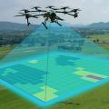
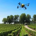
Some fly over seedlings under drone propellers. Others monitor a plot of land, firmly planted in the ground. Others again can be found on machines or tractors and indicate the presence of pests or preside over application rates. Whether in the form of sensors or high resolution cameras, these devices define precision agriculture, which is capable of regulating its action based on the information collected in an area of activity that is inevitably heterogeneous, for it is constantly evolving. “It started out as a “push” technology, which produced mapping, but did not meet specific demands”, Véronique Bellon-Maurel, director of INRAE's NUMM research division and of the #DigitAg institute for the convergence of digital agriculture in Montpellier, points out. “It attracted limited interest in France two decades ago, contrary to the United States and Australia where farmers do not know all their land plots given the extent of farm areas. However, its potential advantages were rapidly identified.”
And first and foremost so by a scientific community that increasingly focuses on the impacts of production on resources and vice versa. For instance at INRAE's EMMAH Joint Research Unit in Avignon, which specializes in the study of the interaction between agricultural practices, water resources and crop conditions, “in other words crop responses to practices and resources”, as stated by its director, Stéphane Ruy. “The close observation of what takes place within a plot makes it possible to adjust practices such as fertilization or irrigation based on soil data.” Data collection is the key step in a process which is often hastily summarised as remote sensing, which actually brings together several approaches.
A multi-level issue
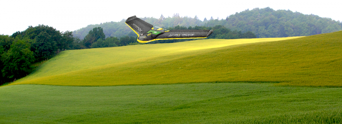
“Our work is based on two major techniques”, explains Frédéric Baret, head of the CAPTE1 Mixed Technology Unit within EMMAH. “Satellite remote sensing [cf. Article 6], used every five days, gives an idea of the heterogeneity of a plot, provides knowledge of soil and vegetation conditions, and generates a model-based map, for instance of soil water requirements.” Such high resolution from above is supplemented by the use of centimetric resolution on a daily basis for smaller areas using drones, robots and fixed sensors, depending on the proxy detection method2. “Three types of sensors are in use here”, Frédéric Baret goes on to say. “High resolution cameras will facilitate disease identification. Red-Green-Blue multispectral cameras will make it possible, for instance, to estimate the chlorophyll content of a plant. Finally, the LIDAR3 system, a kind of surface laser scanning process, will produce 3D imagery of the crop.”
The work of scientists therefore consists in comparing the models provided by the satellites with the raw observational data collected by the sensors. The decrease in differences between the data produced by both sources opens the way for the regulation of practices via predictive simulations, and the development of scenarios that could lead to better yields along with a lesser ecological footprint. However, given its extreme precision, could proxy-detection or low-attitude remote sensing do without satellite support? “We are faced with a multi-level issue”, says Frédéric Baret. “There is a contradiction between high resolution and coverage. One is often observed without the other.” The argument also works the other way around. “Proxy or ground-based remote sensing are best suited to weed control”, notes Thierry Caquet, INRAE’s Scientific Director for the Environment. “A weeding robot can be located from space, but not guided. And let’s bear in mind the fact that all these tools must not become “prosthetic techniques”, which separate actors from their purpose.” Human reason is still in command of data and crop treatment.
1 – Acronym for "CAPteurs" (sensors) and "TElédétections" (remote sensing).
2 – The notion of "remote sensing" may apply to drones depending on the resolution and distance of their intervention.
3 – For Light Detection and Ranging
Driven by the digital boom, is precision agriculture poised to incarnate the future of agriculture? The technological evolution will take place. However, it raises several issues. The most pressing of those concerns the costs involved for its users. "Proxy-detection devices as well as drones are not so recent, but they are still expensive", Véronique Bellon-Maurel points out.“A low return on investment explains why their use takes so much time to spread.” The variable performance of the technologies in question also poses a challenge. “Remote sensing is a relatively efficient tool for detecting mineral deficiency. Detecting disease is more complex, especially using drones”, adds the INRAE researcher, who highlights the promising and relevant niche of Scouting Robots4, which are already operative, but still awaiting commercialisation.
A technical approach cannot solve the deeper issue directly linked to the objectives assigned to these systems: that of a quest for an agricultural model. Would the modulation of agricultural practices, which proxy-detection particularly aims for, take precedence over an in-depth understanding of the living world? Xavier Reboud, research director at the Agroecology Unit at INRAE Dijon, endorses this critical position. "These technologies imply the delegation of risk precision without characterizing the way which the environment absorbs risk. Ecosystem services and substitutes for input supplies are very poorly equipped. The conventional farming model remains in place. The needs of the plant are met in relation to yield objectives, but without analysing the actual deficiencies of the plant."
Véronique Bellon-Maurel does not share this point of view, and highlights the contribution of remote-sensing to crop characterization, noting that "organic agriculture requires as much monitoring as conventional agriculture, if not more" in order to meet its standards
Technological euphoria offers no exemption from supporting a sustainable model. All the more reason, according to Thierry Caquet, to question the environmental cost of technologies that partly aim to reduce the agricultural carbon footprint. "This big question has yet to be settled. These technologies have an extensive appetite for rare earth resources, and what about their emissions"
To date, says Frédéric Baret, "digital agriculture represents 17% of the total consumption absorbed by digital communication and calculation". There may therefore still be room for manoeuvre.
4 – Scouting Robots: they have a large degree of autonomy as well as a significant detection capacity. The flagship of such prototypes, the Salto jumping robot was developed by the University of Berkeley in California in 2016, and is now used for rescue operations
Read the whole report: